Zenrin supports drone flight path design

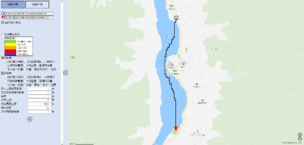
ドローンルート検索機能(Drone route search function)

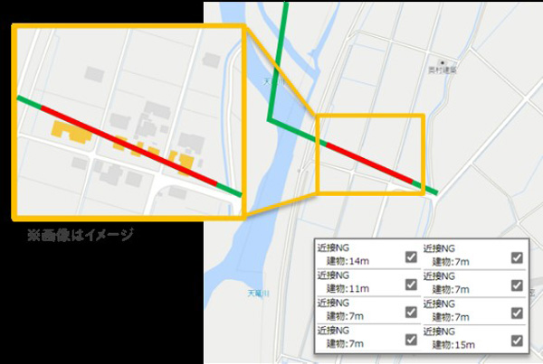
ドローンルート評価機能(Drone route evaluation function)
Zenrin has started offering the “drone route search function” and “drone route evaluation function” on its map API “ZENRIN Maps API” to support flight path design for safe drone flight.
This is the world’s first API service that complies with international standards for geospatial information for drones.
The APIs being offered this time are the “drone route search function” and “drone route evaluation function” for safe drone flight.
The “drone route search function” calculates information on features (roads, buildings, waterways, etc.) around the route and the dispersion range in the event of a drone falling by entering the departure and arrival points of the flight route on Zenrin’s map database, and automatically generates the safest flight route with the lowest risk.
The “drone route evaluation function” is a function that allows you to verify the safety of flight routes created without using the API by entering the coordinates.
Drones are being used in a wide range of fields, with the lifting of the ban on flights beyond visual line of sight in populated areas. However, there remain many cost and safety issues with constructing flight routes, which are the “roads in the sky” that are essential to making flight possible, such as the large amount of work required for route planning and the accuracy of the route depending on the skill of the designer.
To solve these issues, the company has used knowledge gained from drone demonstrations and implementations it has conducted around the country to develop a function that supports the design of safe flight routes that are not dependent on the skill or experience of the worker.
※Translating Japanese articles into English with AI
