AI-based river/reservoir water level monitoring solution NTT docomo group

NTT docomo Group has started trial provision of AI-based river/reservoir water level monitoring solutions for corporations and local governments nationwide.
Through this trial, they will improve the usability of AI functions and applications, and aim to provide the service by March 2024.
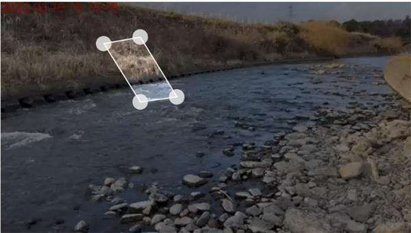
This solution eliminates the need for physical water gauges. Utilizing a virtual water level gauge and AI technology, when a preset water level is exceeded, it automatically notifies the person in charge of river management, and the administrator can visualize the river in real time on the management screen and the time series data of the water level.
Specifically, the current water level can be accurately grasped in real time by installing a special device with a camera in a river or reservoir, displaying a virtual water level gauge on the captured image, and utilizing image recognition AI technology. .
The water level is calculated by a unique algorithm that calculates the water level from the area ratio of the water surface and the land displayed on the virtual water gauge set using segmentation AI technology. By installing multiple virtual water level gauges, the accuracy of AI judgment can be improved.
The administrator can check the water level from the images and graphs on the management screen on the cloud and set various AI settings.
