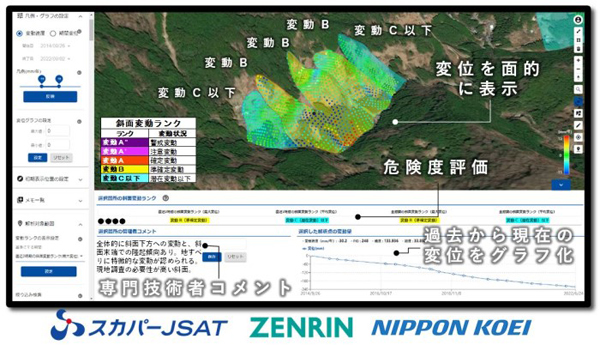
Monitoring changes in infrastructure over time with millimeter precision SKY Perfect JSAT, Zenrin, and Nippon Koei

SKY Perfect JSAT, Zenrin, and Nippon Koei have launched the LIANA (LIANA) service for corporations and local governments that uses satellite data to monitor soil structures such as slopes and embankments, as well as roads, reclaimed land, and surrounding infrastructure over time with millimeter precision. Land-deformation and Infrastructure ANAlysis)” was released.
SKY Perfect JSAT, which specializes in developing SAR image analysis tools, is in charge of analysis for LIANA. It displays the ground deformation in the area that the user wants to check in chronological order, and evaluates the risk based on the ground extensometer standards of the Ministry of Land, Infrastructure, Transport and Tourism and the knowledge of Nippon Koei.
By using satellite images, it is possible to screen a wide area of ??several dozen square kilometers at once, which could not be grasped by surveying alone, so it is possible to reduce the maintenance and inspection costs that corporations and local governments have spent so far. is. In this way, monitoring during normal times enables active management and countermeasures.
